
.png)
Safely is in
Konya & Sarajevo
Safely, with the support of EIT Urban Mobility, aims to transform cities' approach to road safety. To achieve this goal, it uses data-driven insights to take preventive measures before accidents occur.
Project Description
Road safety remains a critical challenge worldwide, with accidents disproportionately affecting Vulnerable Road Users (VRUs) such as pedestrians, cyclists, and motorcyclists. Each year, over 50 million people are injured on roads globally, with more than 1.3 million fatalities, and vulnerable road users like pedestrians, cyclists, and motorcyclists make up over 50% of these deaths.
Many accidents occur at predictable hotspots, yet traditional safety measures often rely on reactive solutions rather than data-driven prevention.
Safely project is changing this approach. Safely project is supported by EIT Urban Mobility, an initiative of the European Institute of Innovation & Technology (EIT), a body of the European Union. Within the project, our solution will be further developed and demonstrated in Konya Büyükşehir Belediyesi (Türkiye) and the Ministry of Traffic of Sarajevo Canton (Bosnia and Herzegovina). Together with our consortium lead and academic partner, Technische Universität Berlin, we aim to create safer urban spaces for all.

SAFELY is being implemented in Konya and Sarajevo, where its risk assessments are guiding real-world safety interventions, including

Enhanced pedestrian crossings for safer walkways

Improved signage and road markings for better visibility

Traffic calming measures to reduce accident risks
Project Partners
SAFELY is developed through a collaborative effort between leading organizations in urban mobility, data science, and road safety research. Our consortium includes:
_edited.png)
TU Berlin
_edited.png)
Parabol
_edited.jpg)
Konya Metropolitan Municipality
Ministry of Traffic of Canton Sarajevo
Together, we are working towards a safer, data-driven future in road safety.

Sarajevo | Bosnia and Herzegovina
A Scalable Solution for Global Road Safety
By harnessing the power of data, SAFELY is helping cities move from reactive accident response to proactive accident prevention—creating safer streets for everyone.
01
Short-term
Impact
Immediate risk reduction in
high-priority accident zones
02
Medium to
Long-term Impact
A replicable model that can be applied to cities worldwide
03
Ultimate
Goal
Supporting the EU’s Vision Zero initiative to eliminate traffic fatalities
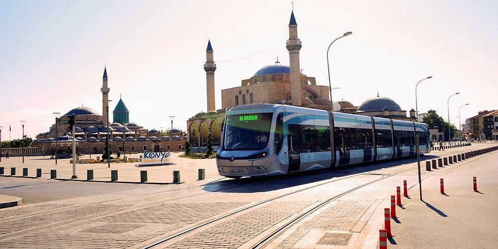
Konya | Türkiye
What is Safely?

Safely is an advanced road safety analytics tool that identifies high-risk accident areas and cause-effect relations based on real-world data. By leveraging big data analytics, ML-driven insights, and predictive modeling, SAFELY empowers city planners, transportation authorities, and policymakers to implement effective, evidence-based safety measures.
The SAFELY tool will be further developed and deployed in two demonstration cities, where it will incorporate various data sources such as location- based accident data which includes accident type, vehicle type, road infrastructure information to provide actionable insights for urban authorities.
Detect high-risk zones before accidents occur
Optimize infrastructure planning for long-term impact
Assess the effectiveness of past safety measures
Unlike conventional GIS-based tools that offer static reports, SAFELY provides dynamic, comparative analysis across multiple locations and time periods, allowing authorities to:
Key Features and Advantages
Comprehensive Hazard Detection and Analysis
SAFELY’s Hazardous Location Detection Model identifies accident-prone areas with high precision. The Hazardous Location Comparison Analysis Module enables users to compare accident patterns across:
•Multiple years to detect long-term trends
•Different regions to identify systemic risks
•Various contributing factors such as weather, road conditions, and traffic volume

These insights help authorities prioritize safety improvements and deploy targeted interventions where they matter most.
Scalable and Adaptable for Various Stakeholders
SAFELY is designed for a broad range of users, including:
-
City and transportation authorities responsible for urban safety
-
Mobility experts and urban planners optimizing traffic management
-
Private companies and research institutions studying road safety trends
Its flexible architecture allows integration into existing systems, making it a valuable tool for both small-scale pilot projects and large-scale urban planning initiatives.
Implementation and Real-World Impact
Advanced Data Processing and Visualization
Traditional road safety tools struggle with large-scale data processing. SAFELY overcomes these limitations by transforming complex datasets into clear, actionable insights through:

-
Heat maps highlighting high-risk areas
-
Trend charts displaying accident patterns over time
-
Scenario-based reports to assess the impact of various safety measures
These visual tools allow stakeholders to understand risk factors at a glance and make informed decisions on safety improvements.

